Planning Department

The purpose of zoning is to regulate the use of land including the use, placement, size of buildings, and yard requirements. This page provides information, links, and answers regarding planning & zoning activities within the Town of Oak Island.

View the following sections for more information.

Bicycle Improvement Plan

Started in 2025, the Town of Oak Island Bicycle Plan will work to identify priority bicycle infrastructure projects to improve bicycle safety, access, and connectivity across the Town of Oak Island.

The plan document will also recommend accompanying policies and programs as well as implementation steps to support and move the projects forward.

Purpose

This plan will replace the 2006 Oak Island Bicycle Plan, and will provide recommendations based on an updated assessment of existing conditions as well as new community-driven vision and goals.

The document and its recommendations will also align with other recent planning efforts (e.g., the Oak Island Drive Streetscape Masterplan).
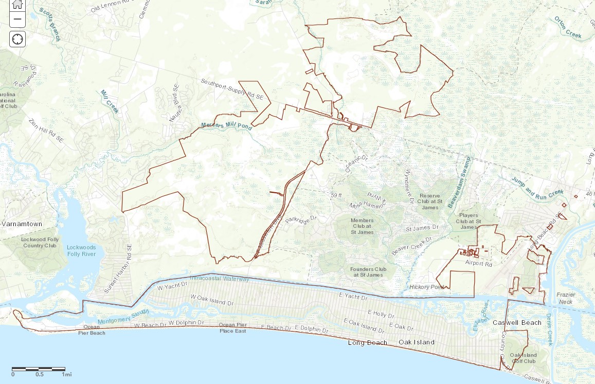
Project Area

The Plan will address all areas within the Town of Oak Island, working to provide a connected network of pathways for safe, efficient travel by bicycle throughout the entire Town.

This will benefit both residents and visitors to the Town of Oak Island as well as the greater region.

See the map below to view the incorporated Town limits (Study Area):

Project Timeline

The plan will be developed over the Summer and Fall of 2025, with an intended plan adoption following its completion.

Over the course of the project, Town staff will be working with infrastructure consulting firm AECOM, who will interact closely with staff from the Development Services Department

To contact the department directly, simply use the Department Contact Form.

Comprehensive Land Use Plan

The Comprehensive Land Use Plan(PDF, 24MB) ("Comp Plan") is a to guide the long-term physical development in Oak Island's town boundary.

The contents of the comprehensive plan consists of the following elements:

  • land use (both existing and future),
  • demographics (existing and projected),
  • housing,
  • infrastructure,
  • economic,
  • recreation, and
  • transportation.

A comprehensive plan is a tool for planning the future growth. Most importantly, a comprehensive plan can be used to address the constant change and evolution of a community. The Comprehensive Plan deals with issues related to the appropriate uses of land. The Oak Island plan addresses compatibility issues between various uses of land, management and preservation of natural resources, and adequate planning for infrastructure needs.

Current Comprehensive Plan(PDF, 24MB)

The "Table Of Uses"

The Table Of Uses established out the rules for what land uses are permitted in each of the Town’s Zoning Districts.

The Unified Development Ordinance (UDO)

The Unified Development Ordinance (UDO) contains the Town's regulations concerning the use and development of land and buildings, and houses the Table Of Uses.

The Town of Oak Island's UDO addresses concerns with zoning districts, permissible types of construction, stormwater restrictions, and natural resource conservation, among other topics.

Right-Of-Way (ROW) Rules

The public Right-Of-Way (ROW), also known as the "streetside" is the real property acquired for public use to construct, maintain, and improve streets and utility infrastructure. The ROW is typically measured from the centerline of the street, towards a property. The Town’s Planning Department may be able to provide an approximate distance based on the specific street, however a true on-ground location would require a survey.

A permit is required prior to construction or reconstruction of a driveway approach.

For full information on what is allowed in the public right-of-way, or to learn more about the existing ordinances already in place, contact the Town Planning & Zoning Administrator through the Department Contact Form.

Planning Forms & Permit Applications

To apply for a permit, request a text change amendment to the UDO, or apply for a variance to the ordinance, please fill out the appropriate application below, and submit to the Permitting Division of the Development Services Department at permits@oakislandnc.gov.

It is highly recommended to scheduling a meeting to discuss an application, prior to signing a lease or beginning activity, to ensure a project doesn’t face any unforeseen obstacles. Staff are generally available each weekday between 8:00 AM - 4:30 PM, but may not always be available, due to meetings, site reviews, and general workload. To schedule an appointment, please call 910-278-5024.

Review the Coastal Area Management Act (CAMA) permitting information from the Division of Coastal Management.

Planning Forms & Permit Applications

Contact the Department

For assistance with any of the information listed, please contact the Department by calling 910-278-5024, or using the Division Contact Form provided below: